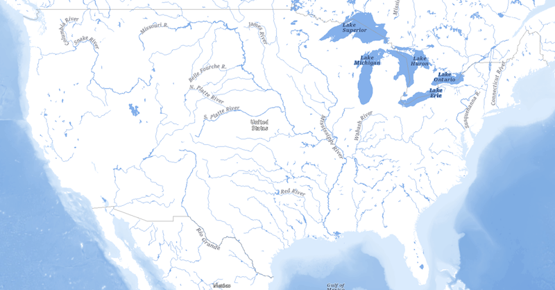
USGS Hydro Cached Base Map Service from The National Map
Access & Use Information
Downloads & Resources
-
Hydro Cached Base Map Service (ArcGIS)Esri REST
CSDGM IMPORT ERROR: No digtinfo/formcont
-
Hydro Cached Base Map Service (WMS)WMS
CSDGM IMPORT ERROR: No digtinfo/formcont
-
Hydro Cached Base Map Service (WMTS)Esri REST
CSDGM IMPORT ERROR: No digtinfo/formcont
-
Web Resource
Dates
| Metadata Date | November 28, 2018 |
|---|---|
| Metadata Created Date | November 11, 2023 |
| Metadata Updated Date | April 15, 2024 |
| Reference Date(s) | January 1, 2018 (publication) |
| Frequency Of Update | asNeeded |
Metadata Source
- ISO-19139 ISO-19139 Metadata
- FGDC Original FGDC Metadata
Harvested from USGS Cached Base Map Services from The National Map
Graphic Preview

Additional Metadata
| Resource Type | Dataset |
|---|---|
| Metadata Date | November 28, 2018 |
| Metadata Created Date | November 11, 2023 |
| Metadata Updated Date | April 15, 2024 |
| Reference Date(s) | January 1, 2018 (publication) |
| Responsible Party | U.S. Geological Survey, National Geospatial Technical Operations Center (Point of Contact) |
| Contact Email | |
| Guid | 7308fb7d-5d8b-4c4b-99db-2b3c95967acc_source |
| Access Constraints | Use Constraints: None. Acknowledgement of the originating agencies would be appreciated in products derived from these data., Access Constraints: None |
| Bbox East Long | -65 |
| Bbox North Lat | 71.5 |
| Bbox South Lat | 17.625 |
| Bbox West Long | -179.999 |
| Coupled Resource | |
| Frequency Of Update | asNeeded |
| Graphic Preview Description | Browse graphic showing US representation at small scale. |
| Graphic Preview File | https://thor-f5.er.usgs.gov/ngtoc/metadata/waf/services/base_maps/browse/basemap-hydro-cached.png |
| Graphic Preview Type | JPG |
| Harvest Object Id | 7308fb7d-5d8b-4c4b-99db-2b3c95967acc |
| Harvest Source Id | 093445ea-f3f8-4657-8d78-60429263e0c3 |
| Harvest Source Title | USGS Cached Base Map Services from The National Map |
| Licence | Although these data have been processed successfully on a computer system at the U.S. Geological Survey, no warranty expressed or implied is made regarding the accuracy or utility of the data on any other system or for general or scientific purposes, nor shall the act of distribution constitute any such warranty. This disclaimer applies both to individual use of the data and aggregate use with other data. It is strongly recommended that these data are directly acquired from a U.S. Geological Survey server, and not indirectly through other sources which may have changed the data in some way. It is also strongly recommended that careful attention be paid to the contents of the metadata file associated with these data. The U.S. Geological Survey shall not be held liable for improper or incorrect use of the data described and/or contained herein. |
| Lineage | |
| Metadata Language | eng; USA |
| Metadata Type | geospatial |
| Old Spatial | {"type": "Polygon", "coordinates": [[[-179.999, 17.625], [-65.0, 17.625], [-65.0, 71.5], [-179.999, 71.5], [-179.999, 17.625]]]} |
| Progress | completed |
| Spatial Data Service Type | |
| Spatial Reference System | |
| Spatial Harvester | True |
Didn't find what you're looking for? Suggest a dataset here.

