
-
Federal
2020 Cartographic Boundary File (KML), Current Unified School District for Colorado, 1:500,000
U.S. Census Bureau, Department of Commerce —
The 2020 cartographic boundary KMLs are simplified representations of selected geographic areas from the U.S. Census Bureau's Master Address File / Topologically... -
Federal
BLM Natl WesternUS GRSG Disturbance Compilation 2021
Department of the Interior —
PDF version of the final report for the 2015 through 2021 Estimates of Disturbance on Greater Sage-Grouse Priority and Important Habitat Management Areas within the... -
Federal
2022 Cartographic Boundary File (SHP), Current State Legislative District-Upper Chamber for Colorado, 1:500,000
U.S. Census Bureau, Department of Commerce —
The 2022 cartographic boundary shapefiles are simplified representations of selected geographic areas from the U.S. Census Bureau's Master Address File /... -
Federal
2022 Cartographic Boundary File (SHP), Current Unified School District for Colorado, 1:500,000
U.S. Census Bureau, Department of Commerce —
The 2022 cartographic boundary shapefiles are simplified representations of selected geographic areas from the U.S. Census Bureau's Master Address File /... -
Federal
Digital Geologic-GIS Map of the Carpenter Ridge Quadrangle, Colorado (NPS, GRD, GRI, CURE, CRRI digital map) adapted from a U.S. Geological Survey Geologic Quadrangle Map by Hedlund and Olson (1973)
Department of the Interior —
The Digital Geologic-GIS Map of the Carpenter Ridge Quadrangle, Colorado is composed of GIS data layers and GIS tables, and is available in the following GRI-... -
Federal
Digital Geologic-GIS Map of the Arriola Quadrangle, Colorado (NPS, GRD, GRI, HOVE, ARRI digital map) adapted from a National Park Service Geologic Resources Inventory geologic map by Poole (2000)
Department of the Interior —
The Digital Geologic-GIS Map of the Arriola Quadrangle, Colorado is composed of GIS data layers and GIS tables, and is available in the following GRI-supported GIS... -
Federal
Digital Geologic-GIS Map of the Little Soap Park Quadrangle, Colorado (NPS, GRD, GRI, CURE, LISP digital map) adapted from a Western State College of Colorado unpublished map by Gaskill, Stork, Fillmore and Coven (1999)
Department of the Interior —
The Digital Geologic-GIS Map of the Little Soap Park Quadrangle, Colorado is composed of GIS data layers and GIS tables, and is available in the following GRI-... -
Federal
Unpublished Digital Geologic-GIS Map of Rito Alto Peak Quadrangle, and northeastern part of the Mirage Quadrangle, Colorado (NPS, GRD, GRI, GRSA, RIAL digital map) adapted from a U.S. Geological Survey Miscellaneous Field Studies Map by Lindsey, Soulliere and Flores (1985)
Department of the Interior —
The Unpublished Digital Geologic-GIS Map of Rito Alto Peak Quadrangle, and northeastern part of the Mirage Quadrangle, Colorado is composed of GIS data layers and GIS... -
Federal
NOAA/WDS Paleoclimatology - Sherriff fire data from Hidden Valley West - IMPD USHV3001
National Oceanic and Atmospheric Administration, Department of Commerce —
This archived Paleoclimatology Study is available from the NOAA National Centers for Environmental Information (NCEI), under the World Data Service (WDS) for... -
Federal
NOAA/WDS Paleoclimatology - Brown fire data from Manitou Demo Plot - IMPD USMDP001
National Oceanic and Atmospheric Administration, Department of Commerce —
This archived Paleoclimatology Study is available from the NOAA National Centers for Environmental Information (NCEI), under the World Data Service (WDS) for... -
Federal
NOAA/WDS Paleoclimatology - Sherriff fire data from Wild Basin 1 - IMPD USWB1001
National Oceanic and Atmospheric Administration, Department of Commerce —
This archived Paleoclimatology Study is available from the NOAA National Centers for Environmental Information (NCEI), under the World Data Service (WDS) for... -
Federal
NOAA/WDS Paleoclimatology - Donnegan fire data from 39 Mile Mtn - IMPD US39M001
National Oceanic and Atmospheric Administration, Department of Commerce —
This archived Paleoclimatology Study is available from the NOAA National Centers for Environmental Information (NCEI), under the World Data Service (WDS) for... -
Federal
BLM Natl GRSG Existing Sagebrush 2019
Department of the Interior —
This document summarizes the potential sagebrush vegetation as well as the 2012 - 2019 sagebrush vegetation availability estimates on Greater Sage-Grouse Priority and... -
Federal
BLM Natl GRSG Greater Sage-Grouse Planning Strategy Sub-Region and EIS Boundaries
Department of the Interior —
EIS boundaries were developed by each individual EIS in coordination with the Division of Decision Support, Planning and NEPA (WO 210). EIS boundary submissions... -
Federal
2022 Cartographic Boundary File (KML), Current State Legislative District-Upper Chamber for Colorado, 1:500,000
U.S. Census Bureau, Department of Commerce —
The 2022 cartographic boundary KMLs are simplified representations of selected geographic areas from the U.S. Census Bureau's Master Address File / Topologically... -
Federal
2020 Cartographic Boundary File (SHP), Current Census Tract for Colorado, 1:500,000
U.S. Census Bureau, Department of Commerce —
The 2020 cartographic boundary shapefiles are simplified representations of selected geographic areas from the U.S. Census Bureau's Master Address File /... -
Federal
2020 Cartographic Boundary File (KML), Current State Legislative District-Lower Chamber for Colorado, 1:500,000
U.S. Census Bureau, Department of Commerce —
The 2020 cartographic boundary KMLs are simplified representations of selected geographic areas from the U.S. Census Bureau's Master Address File / Topologically... -
Federal
2022 Cartographic Boundary File (SHP), Current County Subdivision for Colorado, 1:500,000
U.S. Census Bureau, Department of Commerce —
The 2022 cartographic boundary shapefiles are simplified representations of selected geographic areas from the U.S. Census Bureau's Master Address File /... -
Federal
Areas with Surface Thermal Anomalies as Detected by ASTER and LANDSAT Data in Ouray, Colorado
Department of Energy —
This map shows areas of anomalous surface temperature in Ouray identified from ASTER and LANDSAT thermal data and spatial based insolation model. The temperature for... -
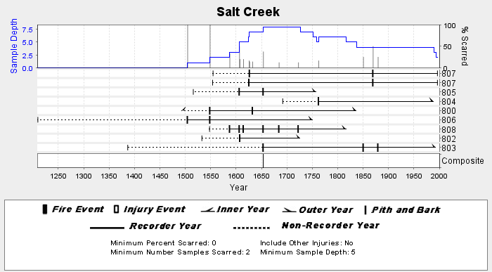
Federal
NOAA/WDS Paleoclimatology - Donnegan fire data from Salt Creek - IMPD USSAL001
National Oceanic and Atmospheric Administration, Department of Commerce —
This archived Paleoclimatology Study is available from the NOAA National Centers for Environmental Information (NCEI), under the World Data Service (WDS) for...

Official websites use .gov
A
.gov website belongs to an official government
organization in the United States.
Secure .gov websites use HTTPS
A
lock (
) or https:// means you’ve safely connected to
the .gov website. Share sensitive information only on official,
secure websites.