

8 datasets found
-
Federal
Georeferenced Population Datasets of Mexico (GEO-MEX): Urban Place GIS Coverage of Mexico 17 recent views
National Aeronautics and Space Administration —
The Urban Place GIS Coverage of Mexico is a vector based point Geographic Information System (GIS) coverage of 696 urban places in Mexico. Each Urban Place is... -
Federal
National Aggregates of Geospatial Data Collection: Population, Landscape, And Climate Estimates, Version 4 (PLACE IV)
National Aeronautics and Space Administration —
The National Aggregates of Geospatial Data Collection: Population, Landscape, And Climate Estimates, Version 4 (PLACE IV) provides measures of population (head... -
Federal
Gridded Population of the World, Version 3 (GPWv3): Centroids
National Aeronautics and Space Administration —
The Gridded Population of the World, Version 3 (GPWv3): Centroids consists of estimates of human population counts and densities for the years 1990, 1995, 2000, 2005,... -
Federal
Georeferenced Population Datasets of Mexico (GEO-MEX): Raster Based GIS Coverage of Mexican Population
National Aeronautics and Space Administration —
The Raster Based GIS Coverage of Mexican Population is a gridded coverage (1 x 1 km) of Mexican population. The data were converted from vector into raster. The... -
Federal
National Aggregates of Geospatial Data Collection: Population, Landscape, And Climate Estimates, Version 2 (PLACE II)
National Aeronautics and Space Administration —
The National Aggregates of Geospatial Data Collection: Population, Landscape, And Climate Estimates, Version 2 (PLACE II) data set contains estimates of national-... -
Federal
National Aggregates of Geospatial Data Collection: Population, Landscape, And Climate Estimates, Version 3 (PLACE III)
National Aeronautics and Space Administration —
The National Aggregates of Geospatial Data Collection: Population, Landscape, And Climate Estimates, Version 3 (PLACE III) data set contains estimates of national-... -
Federal
National Aggregates of Geospatial Data Collection: Population, Landscape, And Climate Estimates (PLACE)
National Aeronautics and Space Administration —
The National Aggregates of Geospatial Data Collection: Population, Landscape, And Climate Estimates (PLACE) data set contains estimates of national-level aggregations... -
Federal
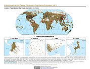
Gridded Population of the World, Version 4 (GPWv4): Administrative Unit Center Points with Population Estimates, Revision 11
National Aeronautics and Space Administration —
The Gridded Population of the World, Version 4 (GPWv4): Administrative Unit Center Points with Population Estimates, Revision 11 consists of UN WPP-adjusted...
8 datasets found