

27 datasets found
-
Federal
Gridded Population of the World, Version 4 (GPWv4): Data Quality Indicators, Revision 11
National Aeronautics and Space Administration —
The Gridded Population of the World, Version 4 (GPWv4): Data Quality Indicators, Revision 11 consists of three data layers created to provide context for the... -
Federal
China Dimensions Data Collection: Bibliography of Chinese Administrative Geography
National Aeronautics and Space Administration —
The Bibliography of Chinese Administrative Geography is a historical collection of bibliographic information on 75 published books describing the administrative... -
Federal
Global Rural-Urban Mapping Project, Version 1 (GRUMPv1): Urban Extent Polygons, Revision 02
National Aeronautics and Space Administration —
The Global Rural-Urban Mapping Project, Version 1 (GRUMPv1): Urban Extent Polygons, Revision 02 is an update to Revision 01, which included new settlements and... -
Federal
Global Rural-Urban Mapping Project, Version 1 (GRUMPv1): Urban Extents Grid
National Aeronautics and Space Administration —
The Global Rural-Urban Mapping Project, Version 1 (GRUMPv1): Urban Extents Grid distinguishes urban and rural areas based on a combination of population counts... -
Federal
Global Rural-Urban Mapping Project, Version 1 (GRUMPv1): National Administrative Boundaries
National Aeronautics and Space Administration —
The Global Rural-Urban Mapping Project, Version 1 (GRUMPv1): National Administrative Boundaries are derived from the land area grid to show the outlines of pixels... -
Federal
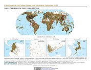
Gridded Population of the World, Version 4 (GPWv4): Administrative Unit Center Points with Population Estimates, Revision 11
National Aeronautics and Space Administration —
The Gridded Population of the World, Version 4 (GPWv4): Administrative Unit Center Points with Population Estimates, Revision 11 consists of UN WPP-adjusted... -
Federal
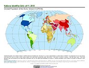
Gridded Population of the World, Version 4 (GPWv4): National Identifier Grid, Revision 11
National Aeronautics and Space Administration —
The Gridded Population of the World, Version 4 (GPWv4): National Identifier Grid, Revision 11 is a raster representation of nation-states in GPWv4 for use in...
27 datasets found